Documentation and Heritage Management Plan
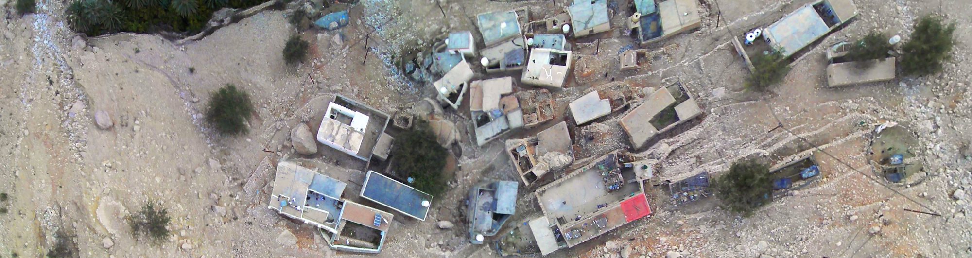
Harat al-Gila, Wadi Shaab
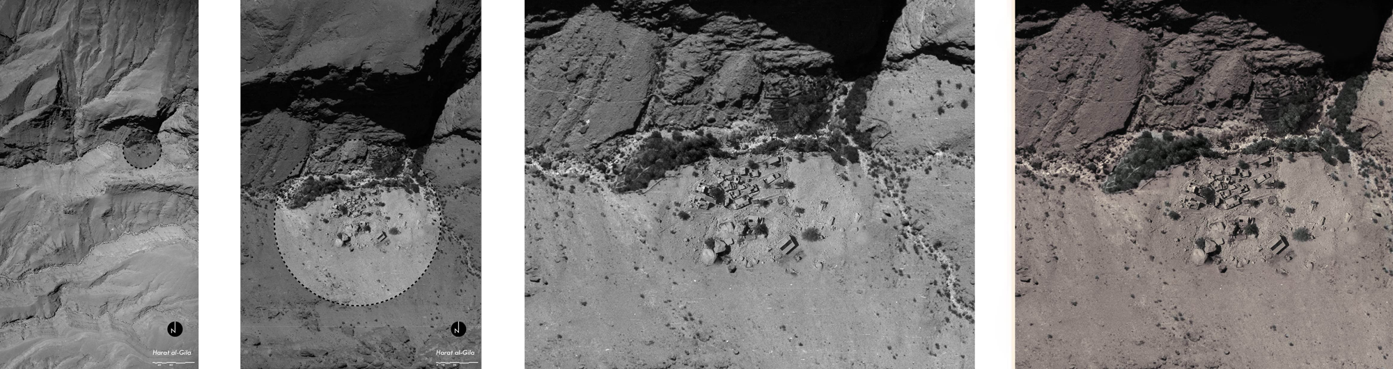
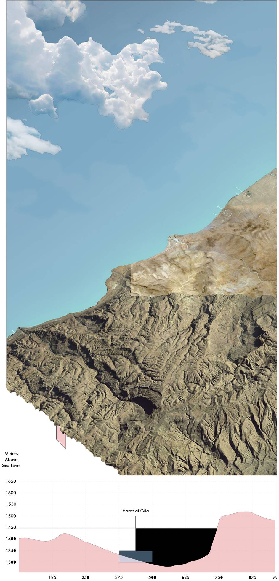
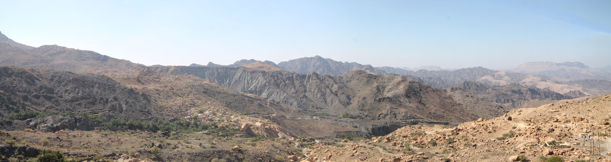
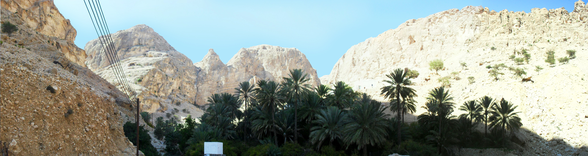
The site of al-Gilā, included into the UNESCO ‘Aflaj Irrigation Systems of Oman’ WHS, lies deep within the Sharqiya Mountains in a difficult to reach area, located at the headwaters of the Wādi Shaab.
About the project
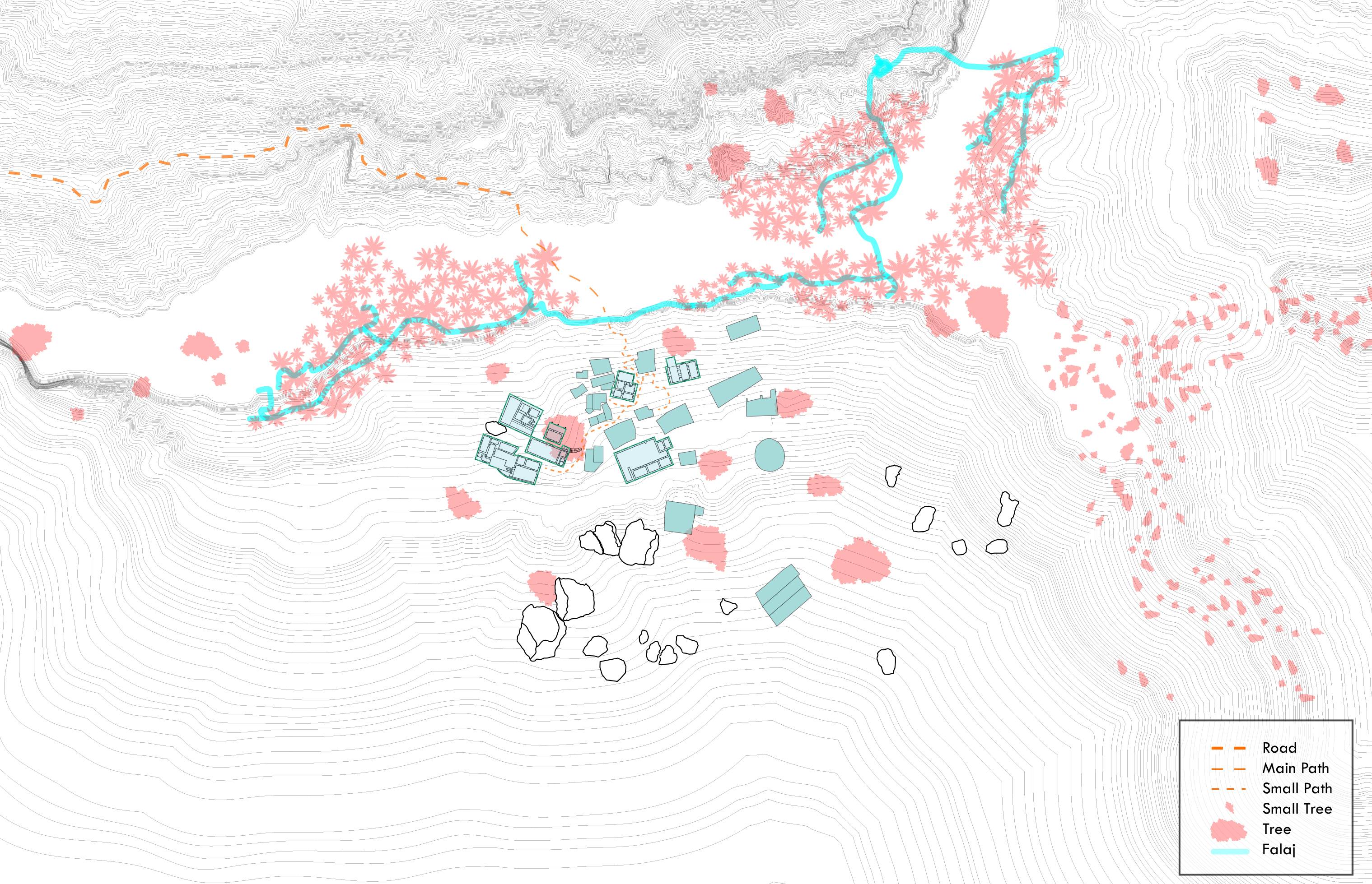
This Documentation and Heritage Management Plan is concerned with the diminutive and difficult to reach mountain settlement of Harat al-Gila and its environs.The fieldwork documentation was carried out on site in Autumn 2013. The Master Plan is informed by extensive documentation, analysis and interpretation of the urban structure, morphology, building typology and social conditions of the present and the immediate past.
Given the small settlement size and also its extremely important regional context, it was decided to have a wider focus to this document beyond the built characteristics of the hārah. The scope in therefore widened to include the surrounding wādi systems (Shaab and Tiwi) as well as the Shir Plateau and its numerous archaeological sites. The aim is to emphasise the need for studying natural settings and human habitation systems together at regional scale.
Related publications


Documentation and analysis drawings